Agora Open Air Museum
- 18 Nov - 24 Nov, 2017
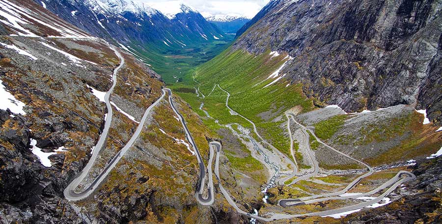
The stretch of road that climbs up the mountain is not particularly long, but the National Tourist Route from Geiranger to the bottom of Romsdal valley cover a ground of 100 kilometres. It takes one through the mighty nature of Fjord Norway and offers breathtaking views, steep mountain slopes and high waterfalls. Framing the experience are lofty mountains with names like Kongen (“the King”), Dronningen (“the Queen”), Bispen (“the Bishop”) Trollveggen (“The Trolls Wall”), Romsdalshorn and Alnestind.
Ørnevegen (“the Eagle Road”) is the name given to the steepest part of the road up the mountainside from Geiranger to Eidsdal, 620 metres above sea level. Here, the road twists through 11 hairpin bends as it climbs up to Stigrøra, 858 metres above sea level.
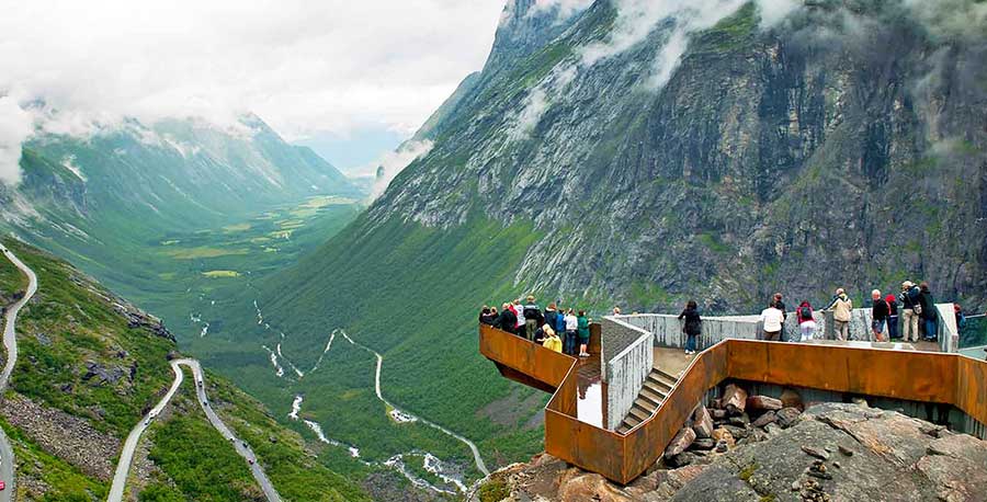
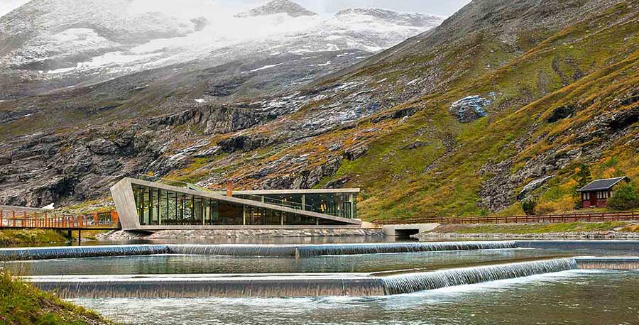
The road is carved into the mountain and supported by stone walls. An impressive bridge carries the road across the Stigfossen waterfall. On this road, even the bravest can feel the adrenaline pump through their veins. The Trollstigen platform and two viewpoints are designed by Reiulf Ramstad Architects. From the top, well protected against the elements by steel and glass, one can see all the way down the mountainside. The structure is designed so that it blends in with the surroundings. Some parts are carved into the rock, whilst other parts are built on stone walls.
In the summer season, 2,000 cars pass the Trollstigveien Plateau, which equals to one car every 10 seconds. But you won’t only encounter motorised vehicles on your journey up Trollstigen. More and more people choose to see the view from their bike; climb the 10 percent inclines effortlessly with an electric bike from Hotel Aak in Åndalsnes, or rent an ordinary bike in the city centre.


COMMENTS