Agora Open Air Museum
- 18 Nov - 24 Nov, 2017
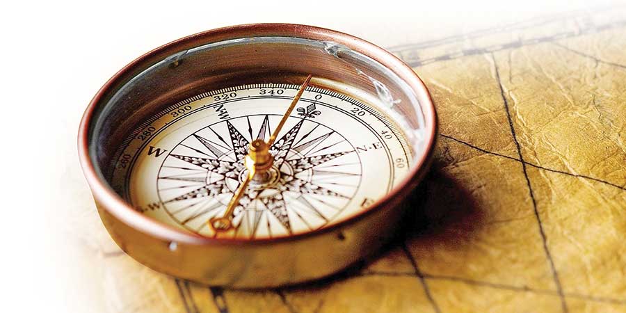
It is widely believed that the Chinese developed the compass for use in feng shui, and mariners later developed it further for use in navigation. The earliest evidence of the magnetic compass is found in the Persian work called Collection of Stories by Muhammad al-Awfi.
The year was 1233, and the voyage was over the Red Sea and the Persian or Arabian Gulf. The compass was described as follows: “a fish made of iron is rubbed with a magnetic stone and then put in a bowl filled with water; it rotates until it stops, pointing to the south.”
The first full description of the use of the magnetic compass for navigation in the Islamic world was by Baylak al-Qibjaqi in his The Book of Treasure for Merchants Who Seek Knowledge of Stones, written in Egypt in 1282. He described the use of a floating compass during a sea voyage from Tripoli in Syria to Alexandria in 1242. He wrote that “an iron needle is joined crosswise with a rush and put in a bowl filled with water. Then a magnetic stone is brought close to this device, and the hand holding the magnetic stone describes a circle clockwise above it. The cross of the needle and the rush follows this move. When the magnetic stone is suddenly removed, the needle is supposed to be aligned with the meridian.”
Willow wood or pumpkin “fish” designs that had magnetic needles were also mentioned. These were sealed with tar or wax to make them waterproof, as they floated on the water. They were known as wet compasses, but there was also a dry compass. Here, two magnetised needles are on opposite sides of a disc of paper, and in the middle is something like a funnel. This funnel rotates on an axis, which is pivoted in the middle of a box sealed with a plate of glass to prevent the disc of paper from dropping.
These designs and uses of the compass were taken to Europe by Muslim traders, who developed them further. As well as having developed navigation instruments, Muslims were also master navigation. Ibn Majid was such a person from Najd, in Arabia, in the 15th century. It ran in the family, as both his father and grandfather were Mu’allim, or masters of navigation, knowing the Red Sea in detail. He knew almost all the sea routes from the Red Sea to East Africa, and from East Africa to China. He wrote at least 38 treatises about those, some in prose, others in poetry, of which 25 are still available. These talk about astronomical and nautical subjects, including lunar mansions, sea routes, and the latitudes of harbours.
But the most important navigator was the 16th century admiral Piri Reis, whose 450-year-old book of sailing instructions, Kitab-i-bahriyye, is known in translation by three names, The Book of the Mariner, The Naval Handbook, and The Book of Sea Love. It was recently published in 1991 by the Turkish Ministry of Culture and Tourism, and this new printing includes a colour copy of the original manuscript, with the Ottoman text translated into Latin, modern Turkish, and English.
The Book of Sea Lore by Piri Reis was a mariner’s guide to the coasts and islands of the Mediterranean, and paved the way for modern sea travel. It was also known as a portolan, and was a comprehensive guide to nautical instructions for sailors, containing maps covering coastlines, waterways, ports, and distances of the Mediterranean coast. It gave sailors instructions and good knowledge of the Mediterranean coast, islands, passes, straits, bays, where to shelter in the face of perilous seas, and how to approach ports and anchor. It also provided directions and precise distances between places.


COMMENTS